Photo : Sefidrud
Photo by:
Afshin Iranpour
Province:
GilanAdditional Information:
Dimensions:
4000 * 3000
File Size:
4693859
Make:
Canon
Maker Note:
Model:
Canon PowerShot G9
Mime:
image/jpeg
DateTime:
2012:06:15 15:46:46
Shutter Speed Value:
309/32
Aperture Value:
128/32
Exposure Bias Value:
0/3
Flash:
16
Focal Length:
16822/1000

Description:
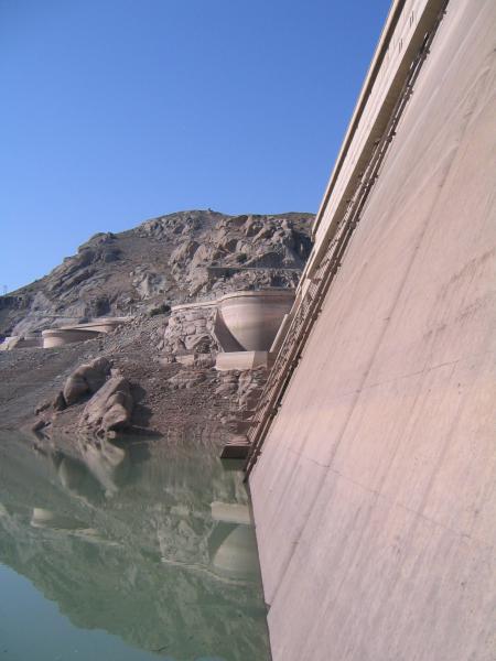
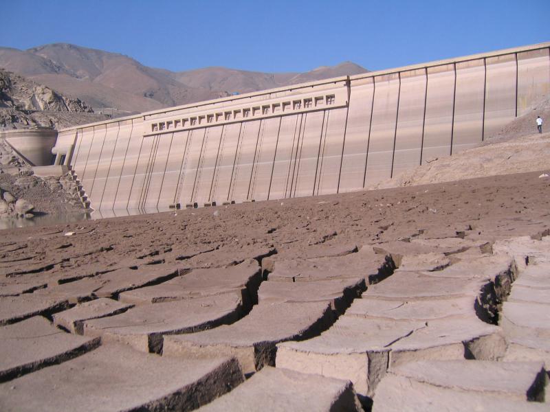
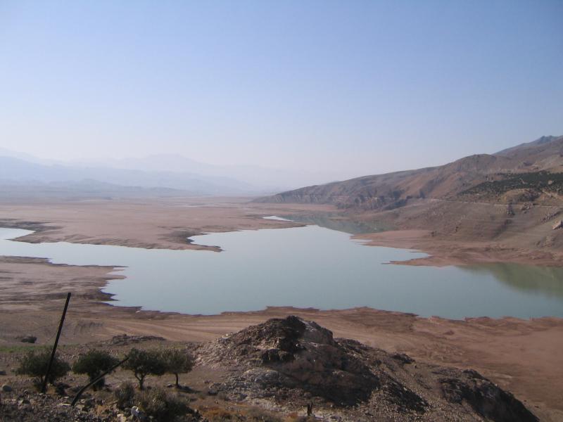
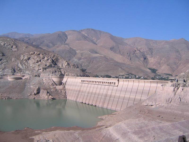
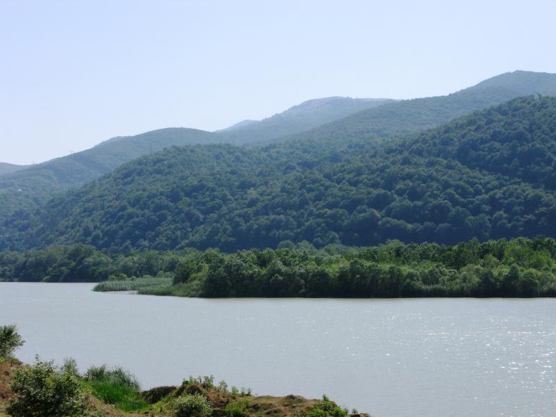
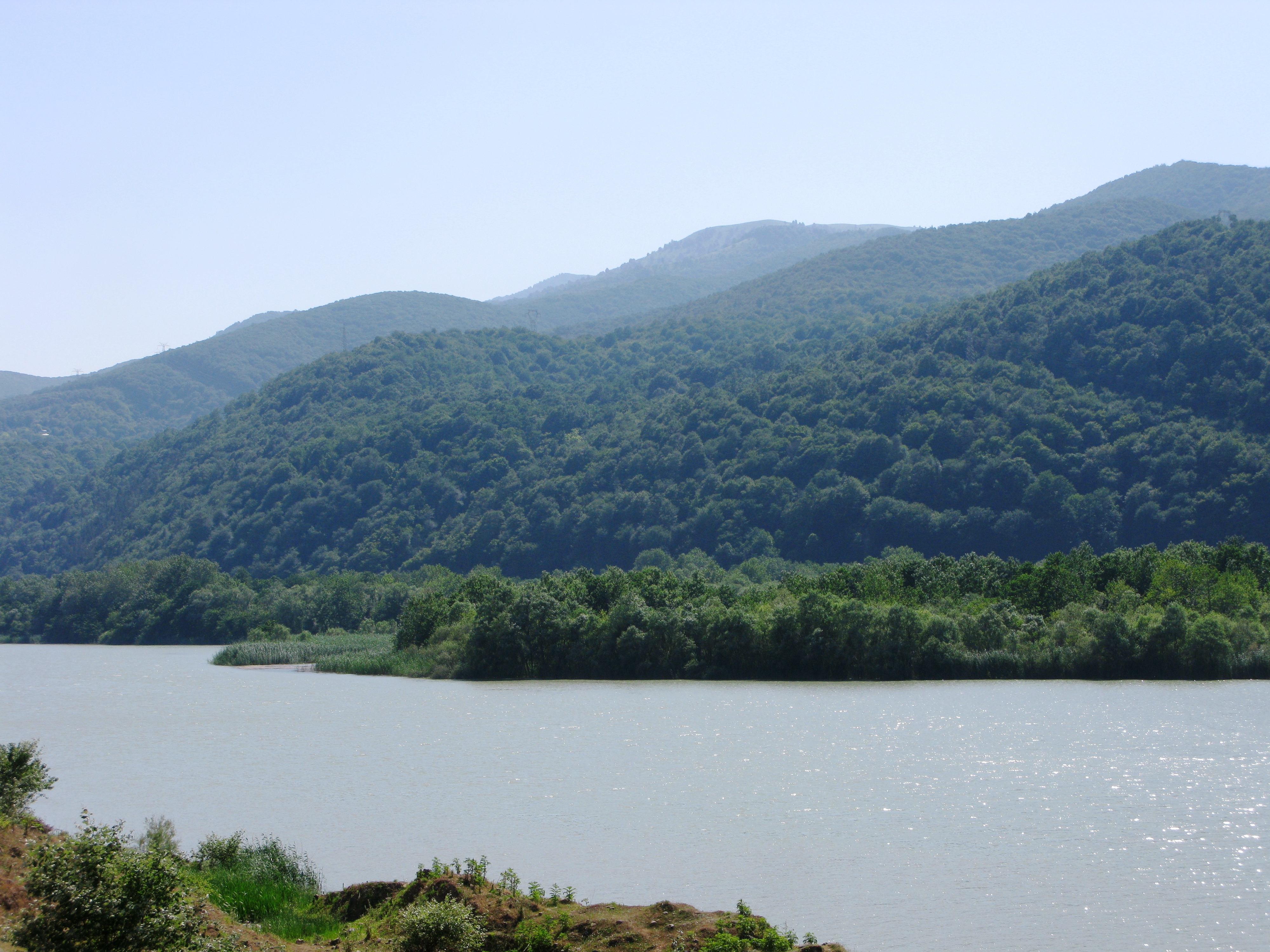
The Sefīd-Rūd "White River") is a river approximately 670 kilometres (416 mi) long, rising in northwestern Iran and flowing generally northeast to meet the Caspian Sea at Rasht. The river is Iran's second longest river after the Karun. Sefid Rud has cut a water gap through the Alborz Mountains, the Manjil gap,[1] capturing two headwater tributaries and widening the valley between the Talesh Hills and the main Alborz range. The gap provides a major route between Tehran and Gīlān Province with its Caspian lowlands. Other names and transcriptions include Sepīd-Rūd, Sefidrud, Sefidrood, Sepidrood, and Sepidrud. Above Manjil, the river was known as Qizil Uzun, "Long Red River". The river is famous for the quantity of its fish, especially the Caspian trout, Salmo trutta caspius In the wide valley before Sepid Rud enters the Caspian a number of transportation and irrigation canals have been cut; the two biggest are the Khomam and the Now. The river was dammed in 1962 by the Shahbanu Farah Dam (later renamed Manjil Dam) which created a 1.86 cubic kilometres (0.45 cu mi) reservoir and allowed the irrigation of an additional 2,380 km2 (919 sq mi). The reservoir mediates some flooding and significantly increased rice production in the delta.The hydroelectric component of the dam generates 87,000 kilowatts. The completion of the dam had a negative impact on the river's fisheries, through reduced stream flow (due to diversion), increased water temperature, and decreased food availability, especially for sturgeon but also for the Caspian trout.
Download this photo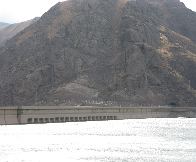

